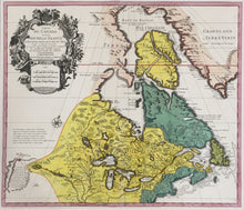
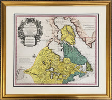
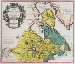
After Guillaume Delisle (1675-1726). “Carte Du Canada ou de la Nouvelle France.”
Amsterdam: Jean Covens & Corneille Mortier, ca. 1730. 19 1/8 x 22 1/2. Engraving. Attractive modern hand color. Not examined out of the frame. Very good condition. A/A
An attractively colored example of Delisle’s famous map of the Great Lakes and Canada. The map was first issued in 1703, and this example was issued not too long after in Amsterdam. Delisle is known as the “father of scientific cartography,” an honorary title earned through his production of maps based upon the scientific principals of using only first-hand information, survey reports and accurate readings of longitude and latitude. Delisle’s maps had an immense impact on the history of cartography, for they were the genesis of the eventual establishing of these principals as the standard for all cartographers. This map is a important example of his work, seminal in the history of the mapping of America exactly because of Delisle’s pioneering method and attitude. It was based on years of research, using all the latest reports of travels, explorations and surveys in the region. Delisle was particularly well placed with respect to gathering information on North America, for with his connections in the French court, especially within the Ministry of Marine, he had access to all the official and unofficial reports coming out of New France. It is not surprising, then, given Delisle’s method and connections, that this map is so important in the cartographic history of the continent.
The map was the result of seven years research by Delisle and his father Claude, information being gathered from the reports of Franquelin, Joliet, Baron Lahontan and others. The depiction of the Great Lakes is a landmark in the history of their mapping, superior to the previous renderings by Sanson and Coronelli. This map is a “mother map” of both Canada and the Great Lakes. Such was its importance that it continued to be published for the rest of the century. The wonderful baroque title cartouche adds a final flourish to the map, showing natives, flora and fauna, and explorers of the New World.


