
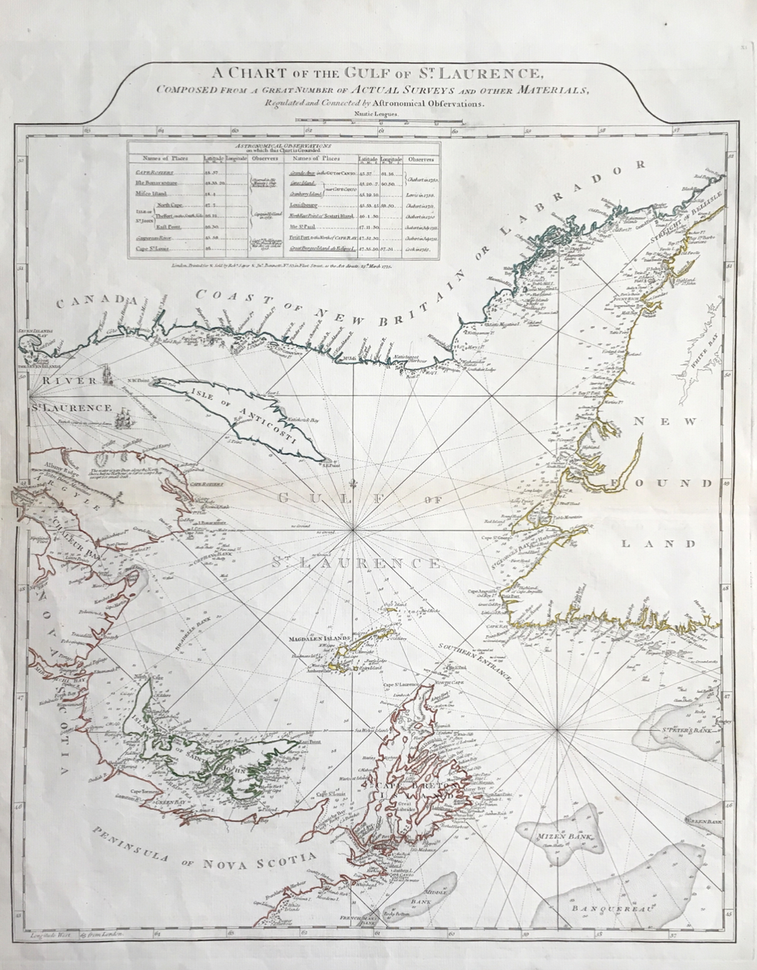
British Admiralty. “A Chart of the Gulf of St. Laurence . . . by Astronomical Observations”
London: R. Sayer & J. Bennett, 1775. 24 3/4 x 20 (platemarks). Engraving. Excellent condition.
Following the French and Indian War, 1754-63, the British Admiralty had many surveys and maps done of the waters in and around North America. The official publisher for the Admiralty was J.F.W. DesBarres who was working his way from North to South using many ships and mapmakers. As commerce increased and the Americans began militating over legal and economic differences with Great Britain, commercial map making firms used the DesBarres surveys to create their own maps. This careful astronomically oriented chart shows the two channels around Newfoundland that lead to the St. Laurence River. For commerce and possible military maneuvers, this chart would have had wide distribution.
 %20%0A%20%0Ahttps://philaprintshop.com/products/british-admiralty-a-chart-of-the-gulf-of-st-laurence-by-astronomical-observations %20%0A%20%0ABritish%20Admiralty%20%E2%80%9CA%20Chart%20of%20the%20Gulf%20of%20St.%20Laurence%20.%20.%20.%20by%20Astronomical%20Observations%E2%80%9D %20%0A%20%0A//philaprintshop.com/cdn/shop/products/ScreenShot2021-04-09at4.13.52PM_1024x1024.png?v=1618006451 %20%0A%20%0AAntique Prints, Maps, Drawings, Paintings and Rare Books! %20%0A%20%0AThe Philadelphia Print Shop %20%0A106 E. Lancaster Avenue, Lower Level %20%0AWayne, PA 19087 %20%0A%20%0APhilaPrintShop.com %20%0A@PhiladelphiaPrintShop %20%0A 610 (808) 6165)