
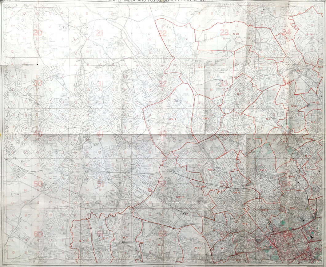
John Bartholomew & Son, Ltd."Bartholomew's Street Index Plan of London, North West Section, Showing the Postal Districts"
Edinburgh: John Bartholomew & Son, Ltd., n.d. Folding map, 34 1/4 x 41 1/2.
This 20th century map of the northwest section of London, from Cleopatra's Needle west through Southall and north to Barnet and Oxhey, is on a scale of 3.4 inches to a mile, has half-mile sections delineated, and shows the postal areas as well.
Bartholomew's was begun by George B. Bartholomew (1784-1871) as an engraving firm. Five generations of the family operated the cartographic company, ending with John B. Bartholomew (1890-1960). The firm was acquired by Reader's Digest Publications in 1990.
 %20%0A%20%0Ahttps://philaprintshop.com/products/bartholomew-john-son-bartholomews-street-index-plan-of-london-north-west-section-showing-the-postal-districts %20%0A%20%0ABartholomew,%20John%20%26%20Son%20%22Bartholomew's%20Street%20Index%20Plan%20of%20London,%20North%20West%20Section,%20Showing%20the%20Postal%20Districts%22 %20%0A%20%0A//philaprintshop.com/cdn/shop/products/bartholomewlondon_1024x1024.jpg?v=1614234365 %20%0A%20%0AAntique Prints, Maps, Drawings, Paintings and Rare Books! %20%0A%20%0AThe Philadelphia Print Shop %20%0A106 E. Lancaster Avenue, Lower Level %20%0AWayne, PA 19087 %20%0A%20%0APhilaPrintShop.com %20%0A@PhiladelphiaPrintShop %20%0A 610 (808) 6165)