


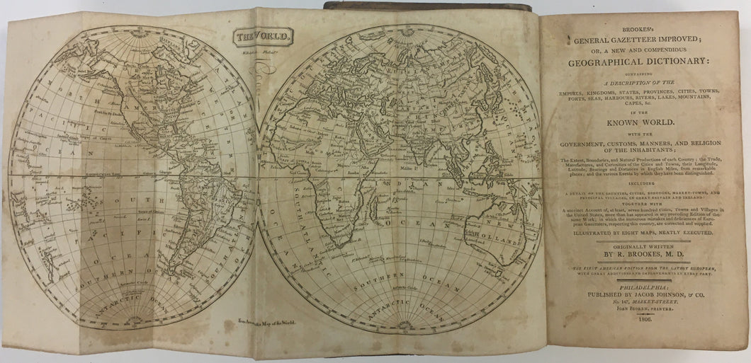

Richard Brookes. Brookes’s General Gazetteer Improved . . ..
Philadelphia: Jacob Johnson, 1806. John Bioren, Printer. Octavo. Xvi, 399ll. 8 maps. Full leather with original leather label on spine. Rehinged. Ref.: Shaw-Shoemaker, 10038. Buck, 8. First American edition following the 12th. London edition. Walsh, p. 113 collates complete.
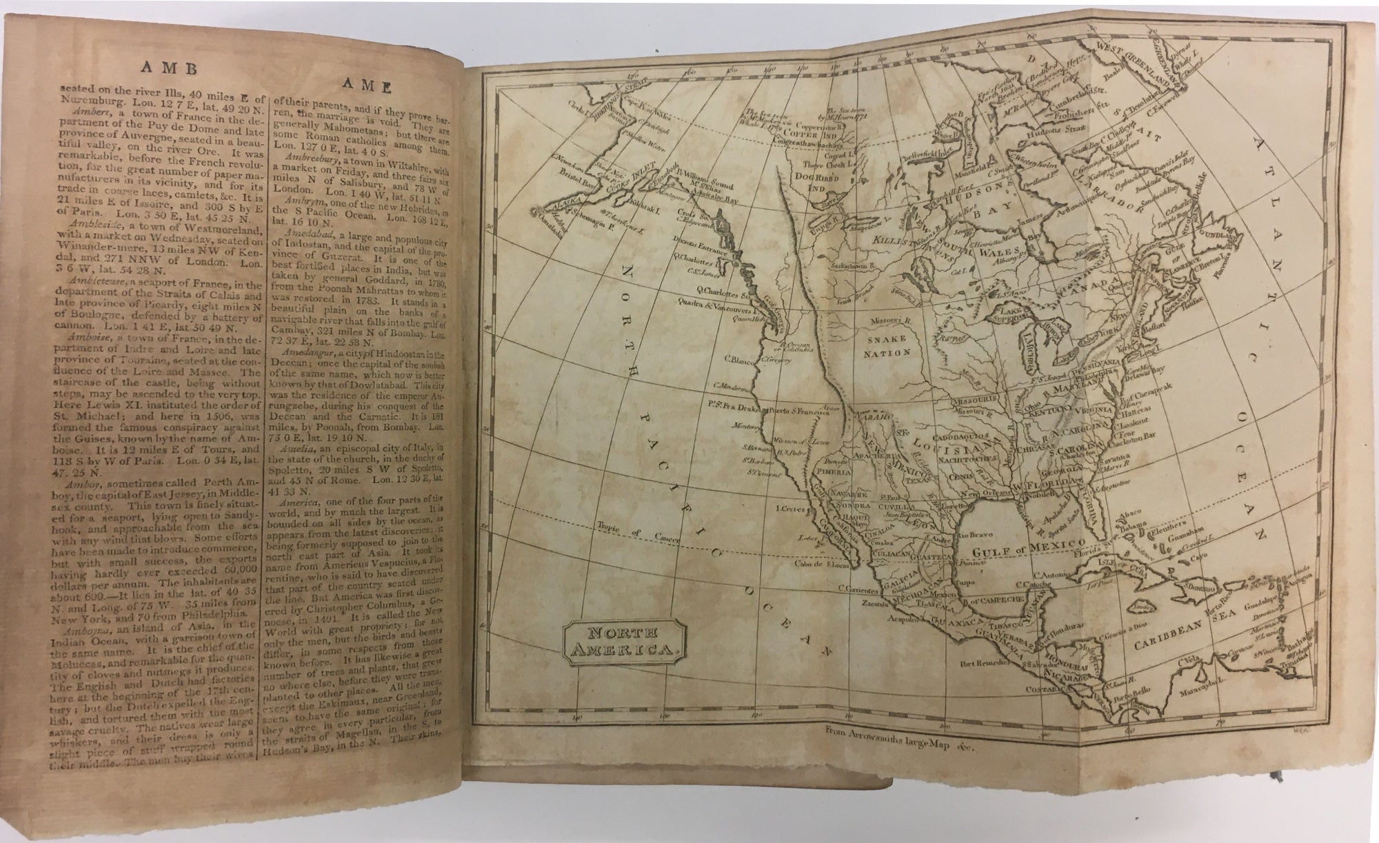
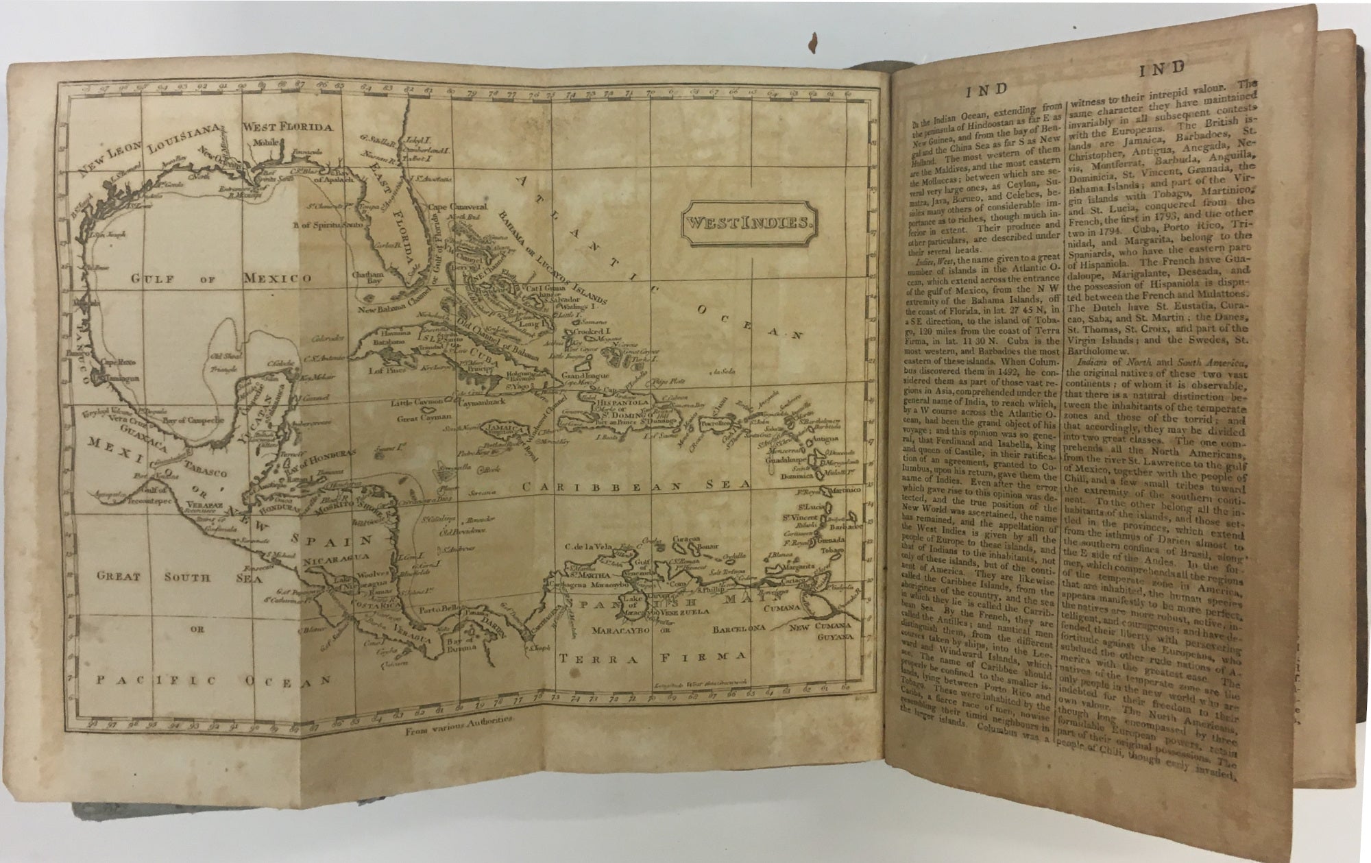
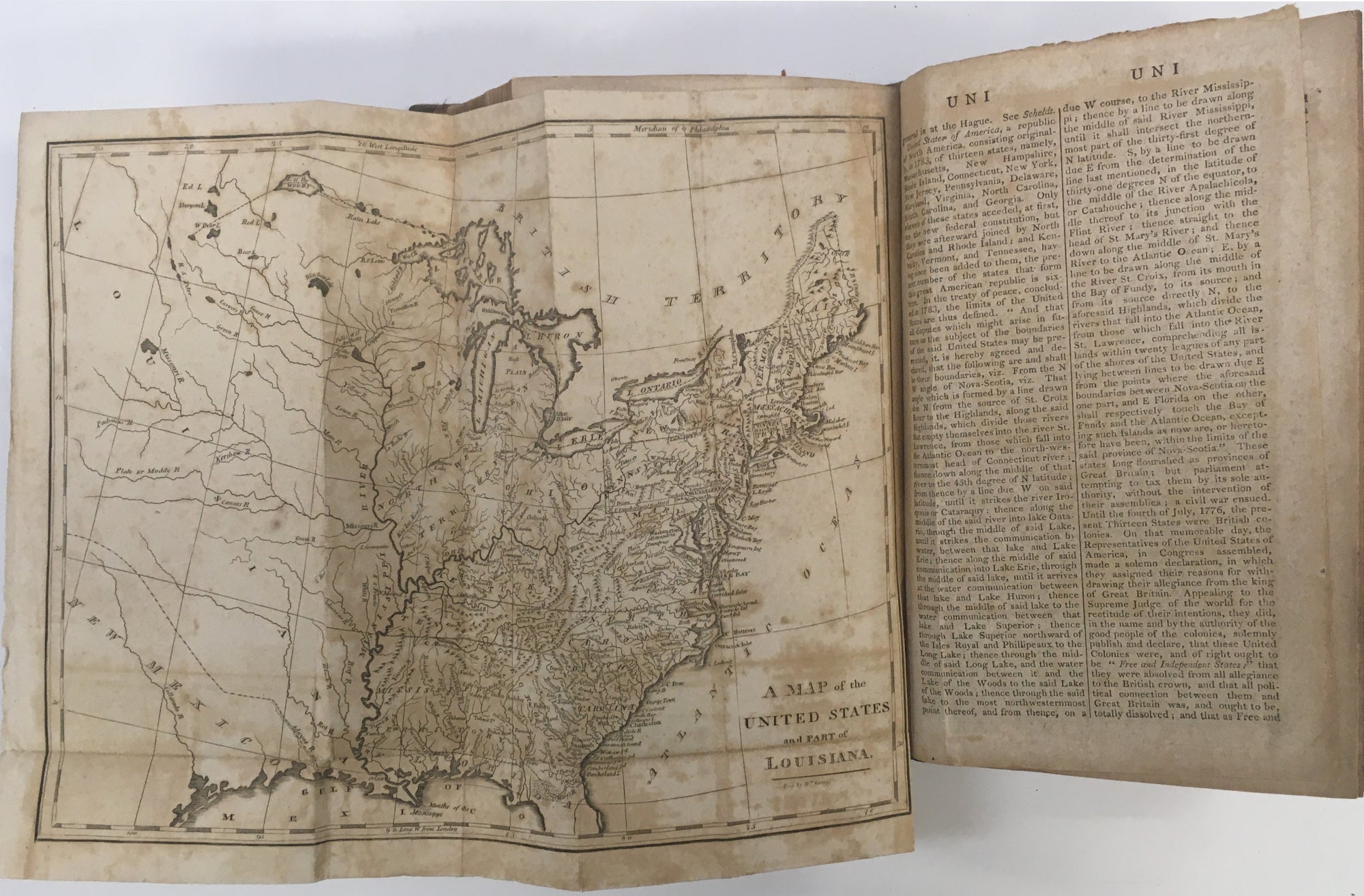
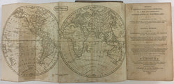
A fine and extensive early Philadelphia gazetteer by a British author with detailed folding maps engraved by William Ralph and William Kneass and are the following:
- “The World” after Arrowsmith.
- “Africa” after Arrowsmith.
- “North America” after Arrowsmith.
- “South America” after Olmadilla/Malespina.
- “Asia” after Arrowsmith.
- “Europe” after Arrowsmith.
- “West Indies” after various authorities.
- “...United States and part of Louisiana” sources not credited but after Bradley.
 %20%0A%20%0Ahttps://philaprintshop.com/products/brookes-richard-brookess-general-gazetteer-improved-1806 %20%0A%20%0ABrookes,%20Richard%20%22Brookes's%20General%20Gazetteer%20Improved%20.%20.%20.%22%201806 %20%0A%20%0A//philaprintshop.com/cdn/shop/products/brookesgazetteer1806a_1024x1024.jpg?v=1658523673 %20%0A%20%0AAntique Prints, Maps, Drawings, Paintings and Rare Books! %20%0A%20%0AThe Philadelphia Print Shop %20%0A106 E. Lancaster Avenue, Lower Level %20%0AWayne, PA 19087 %20%0A%20%0APhilaPrintShop.com %20%0A@PhiladelphiaPrintShop %20%0A 610 (808) 6165)