


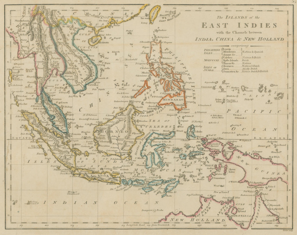
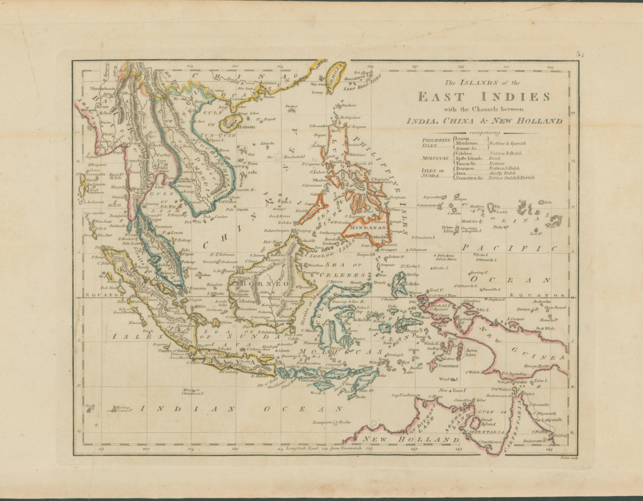
Mathew Carey. "The Islands of the East Indies with the Channels between India, China & New Holland."
Philadelphia: M. Carey, 1814. 8 1/2 x 11. Engraving. Original outline color. Full margins. Excellent condition.
An interesting and attractive map of the East Indies that was drawn, engraved, printed, and hand colored in Philadelphia. The map was published by Mathew Carey in 1814, and was from Carey's General Atlas which represented the best American cartographic work of the period. Carey, an Irish immigrant, established the first American specialized cartographic publishing firm. He set up an elaborate cottage system of craftsmen for engraving, printing, and coloring his maps utilizing the best independent artists directed to a common end. Carey is important, then, not only for the excellent maps he produced, but for his setting the pattern for American map publishing, to be followed by the likes of John Melish and Henry S. Tanner. This map of the East Indies is typical of Carey's output. It contains copious detail presented in a clear manner. Towns, rivers, political divisions and some topography is displayed. This is a fine example of American cartography at the beginning of the nineteenth century.
 %20%0A%20%0Ahttps://philaprintshop.com/products/carey-mathew-the-islands-of-the-east-indies-with-the-channels-between-india-china-new-holland %20%0A%20%0ACarey,%20Mathew%20%22The%20Islands%20of%20the%20East%20Indies%20with%20the%20Channels%20between%20India,%20China%20%26%20New%20Holland.%22 %20%0A%20%0A//philaprintshop.com/cdn/shop/products/careyeastindc_1024x1024.jpg?v=1635266106 %20%0A%20%0AAntique Prints, Maps, Drawings, Paintings and Rare Books! %20%0A%20%0AThe Philadelphia Print Shop %20%0A106 E. Lancaster Avenue, Lower Level %20%0AWayne, PA 19087 %20%0A%20%0APhilaPrintShop.com %20%0A@PhiladelphiaPrintShop %20%0A 610 (808) 6165)