
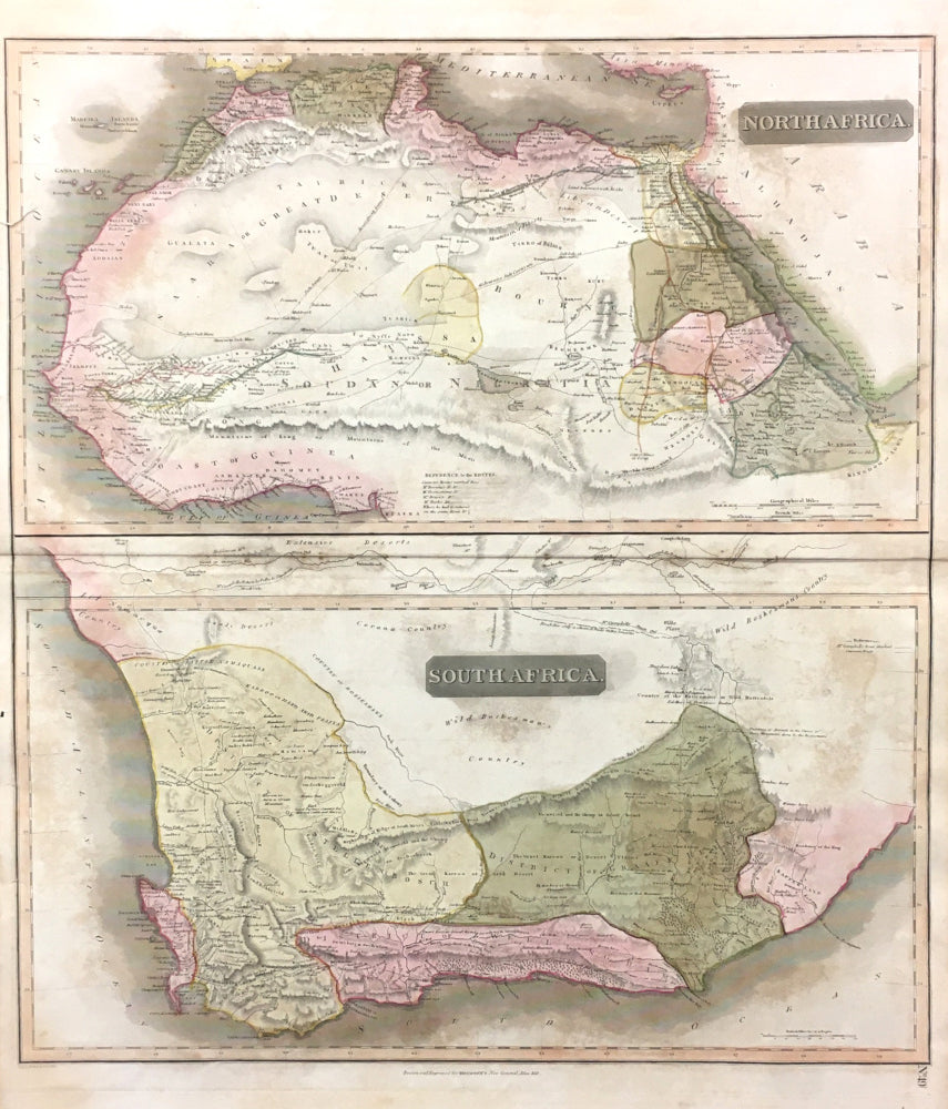
John Thomson. "North Africa. South Africa".
From A New General Atlas. Edinburgh: J. Thomson, 1815. 22 7/8 x 20 3/8. Engraving. Full original hand color. Full margins. Short repaired tears in left margin, not affecting image. Foxing throughout. Else, good condition.
A striking map of North and South Africa from an interesting period in the history of the continent. The map is divided into the two separate geographical areas known to Europeans, with towns carefully named and much attention given to geographical detail. The map is beautifully crafted, with precise engraving and neat hand coloring. The delicate coloring highlights the information given, making the map both easier to read and pleasing to look at. Altogether, a fine example of early 19th-century British cartography.
 %20%0A%20%0Ahttps://philaprintshop.com/products/thomso-john-north-africa-south-africa %20%0A%20%0AThomson,%20John%20%22North%20Africa.%20South%20Africa%22 %20%0A%20%0A//philaprintshop.com/cdn/shop/products/thomsonsafrica_1024x1024.jpg?v=1613348795 %20%0A%20%0AAntique Prints, Maps, Drawings, Paintings and Rare Books! %20%0A%20%0AThe Philadelphia Print Shop %20%0A106 E. Lancaster Avenue, Lower Level %20%0AWayne, PA 19087 %20%0A%20%0APhilaPrintShop.com %20%0A@PhiladelphiaPrintShop %20%0A 610 (808) 6165)