


G.M. Hopkins. “A Map of Kansas City, Missouri.”
Washington D.C., G. M. Hopkins, 1890. 73 2/4 x 72 ¼. Lithograph. Full bright original hand color. Mounted on canvas as originally issued. Old nail holes in top and bottom margins where top rail and bottom roller were once attached. Acid free linen tape on verso top and bottom edges and right hand edge to reinforce canvas backing. Three inch horizontal light brown stain in bottom of map due to varnished bottom roller contacting the map surface over a period of time. Small fill in upper portion of map near border with some scattered repaired tears and cracks in upper portion of map. Two water stains bottom right corner of map. Wear on original blue binding ribbon on map edges mostly right hand side. Light soiling in various areas as to be expected. Otherwise, map is very clean and in very good condition for such an extremely large wall map. Unrecorded and extremely scarce. A/A
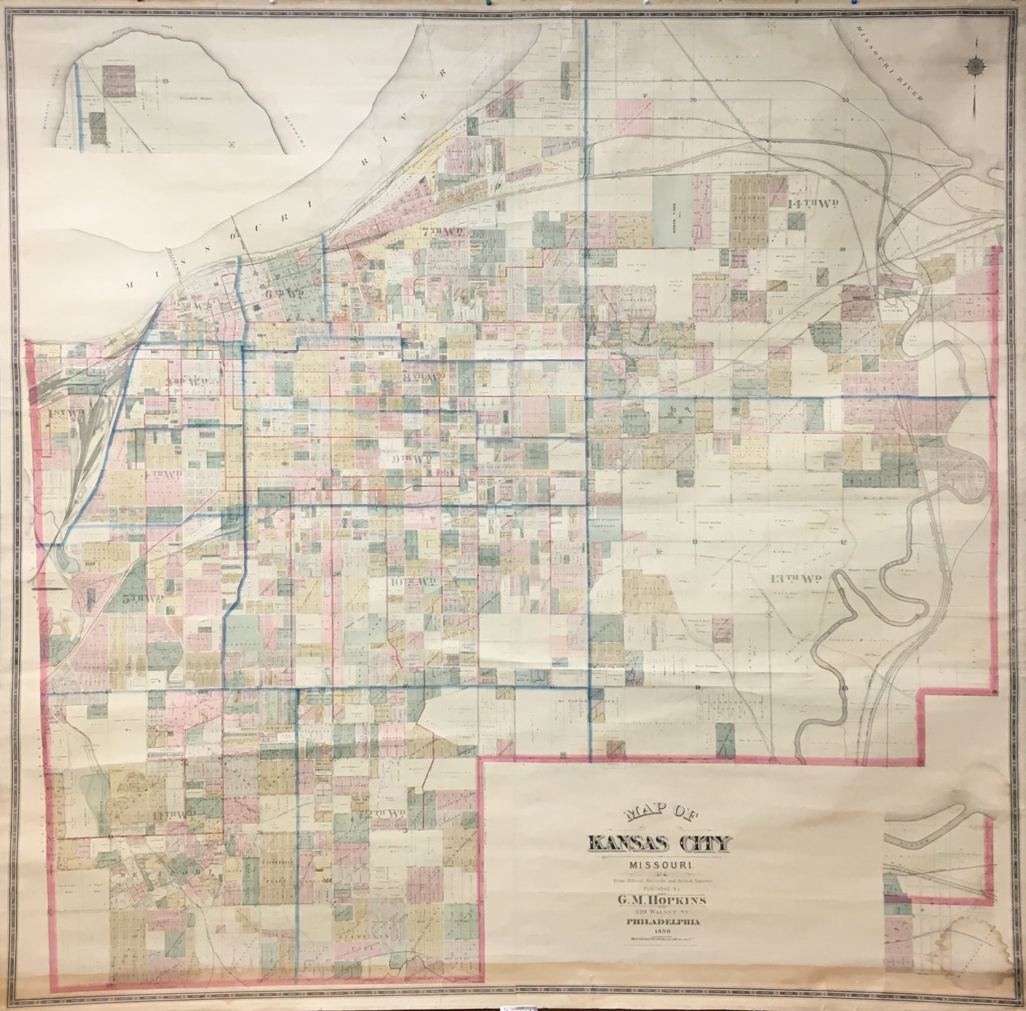
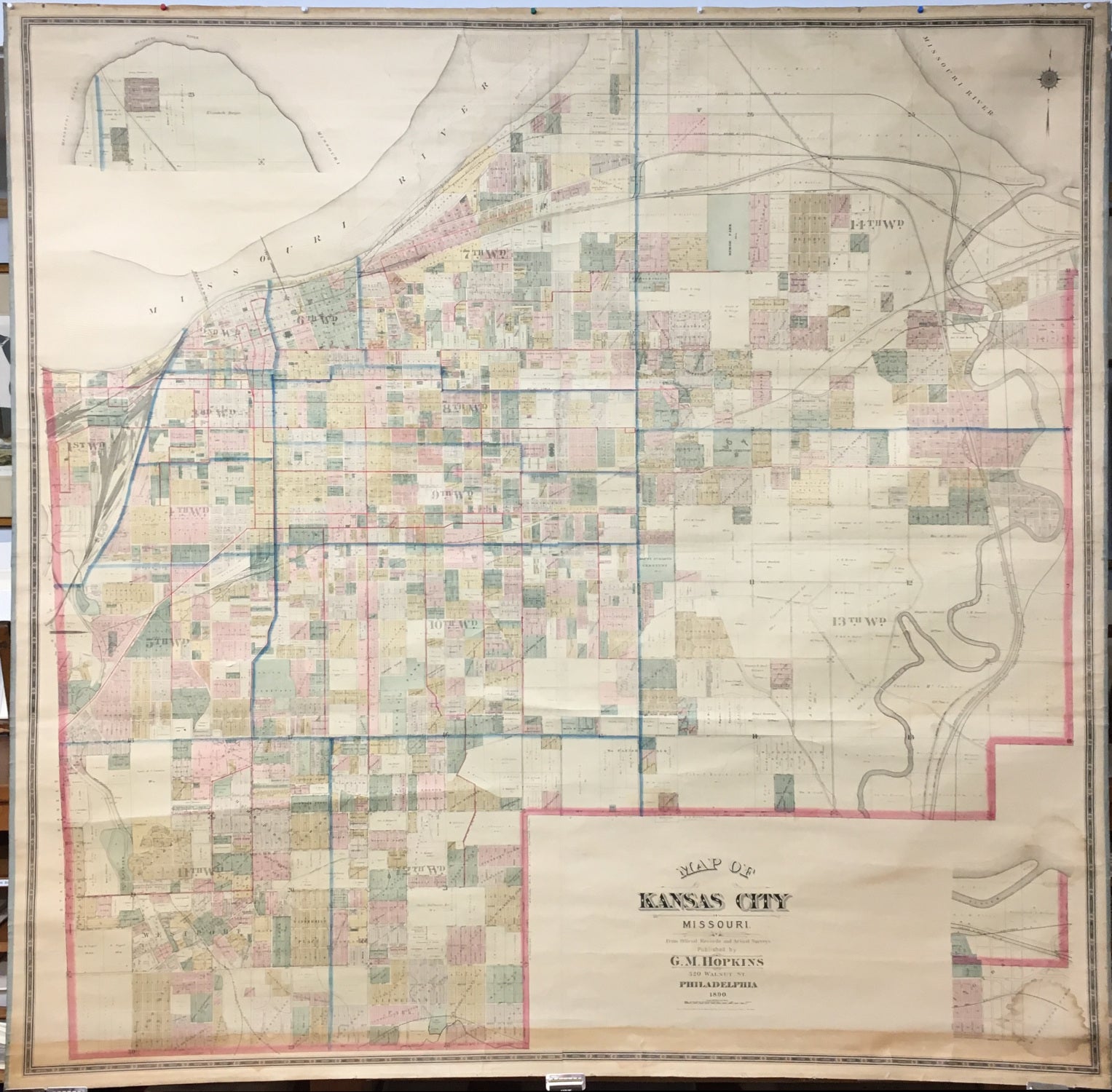
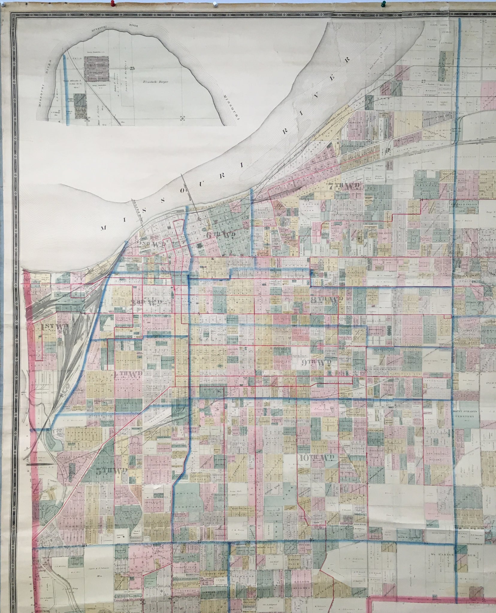
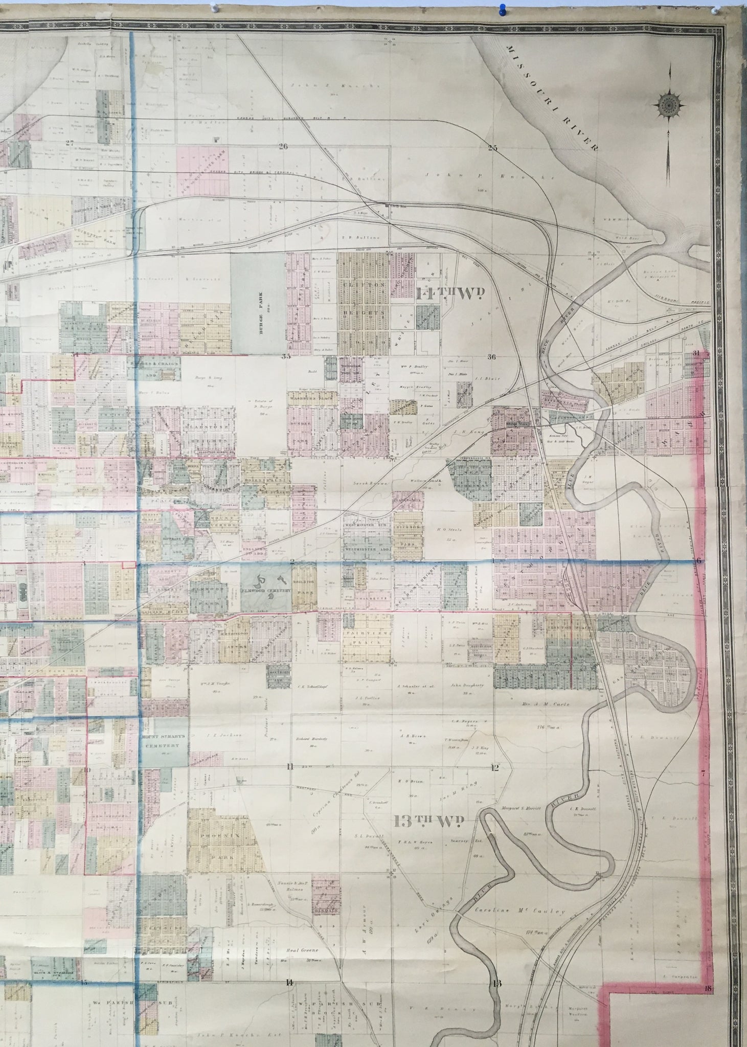
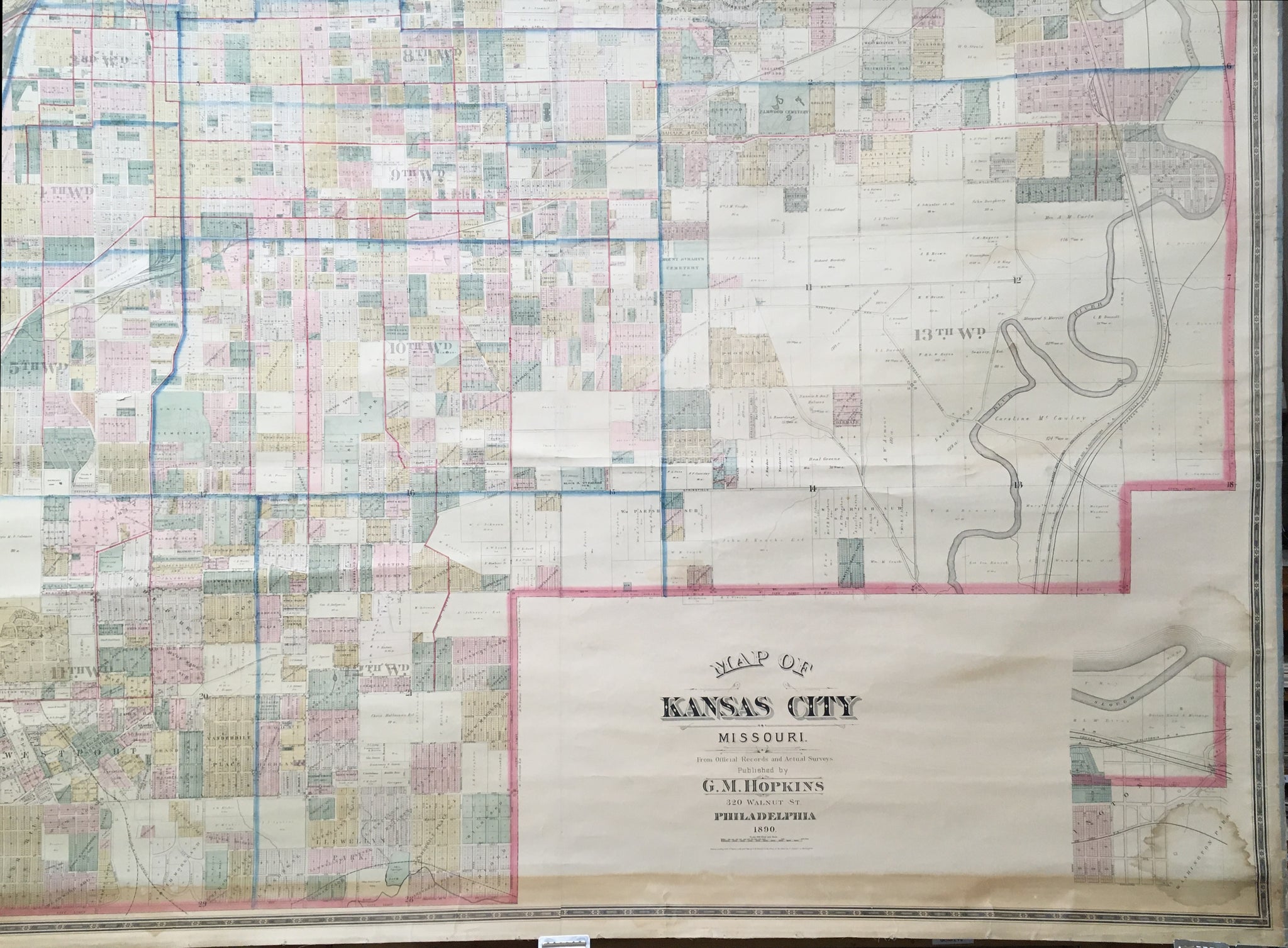
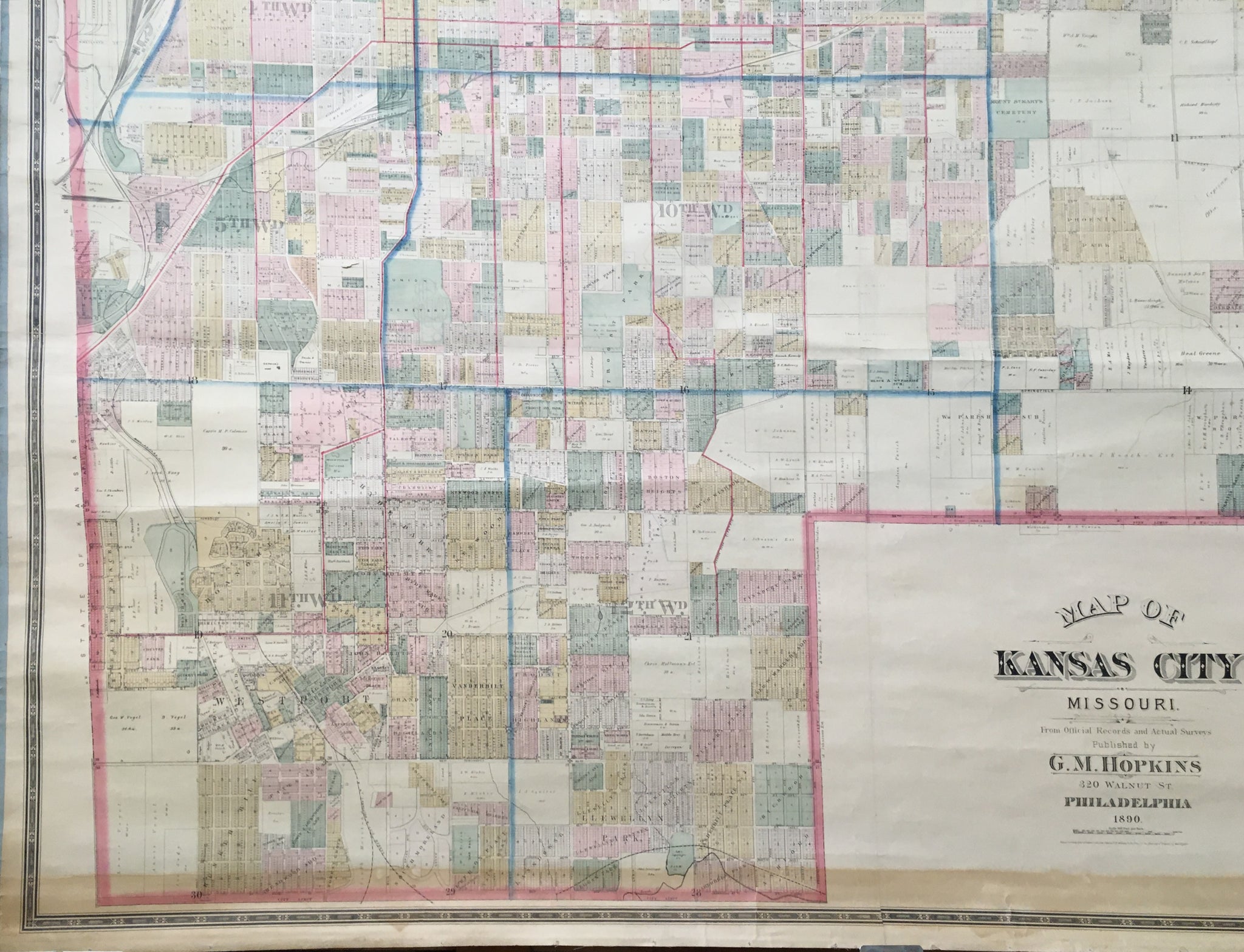
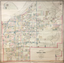
A mammoth wall map of Kansas City issued by the well known Philadelphia map maker G. M. Hopkins. This monumental map shows the city from the northern tip along the Missouri River south to the Bunker Hill and Llewellyn sections of the city. This map was issued one year after the city officially changed its name from City of Kansas to Kansas City.
Copious amounts of information are depicted due to the scale of 500 feet to the inch. Many names of land, business and home owners are depicted. The top left inset map is the northern tip of city along the Missouri River and bottom right inset map is of the Washington section which connects to the map on the upper right hand side.
We could not find any record of this map in any collection, so we conclude it is unrecorded. However, Hopkins issued two different and smaller wall maps of Kansas City in 1889 and 1890. This map is exceptionally clean given that it was never varnished unlike most wall maps of the 19th century. The wall map lacks the original top rail and bottom rollers which were most likely varnished due to the band of browning at the bottom of the map where the roller came in contact with the map when rolled. The vast majority of 19th century wall map rails and rollers were made of pine and painted black.
The Hopkins firm lasted well into the 20th century and it and all its inventory was purchased by the Franklin Survey Company (also known as Franklin Maps) in 1943. This exceptional wall map remained in the company collection until recently.
 %20%0A%20%0Ahttps://philaprintshop.com/products/hopkins-g-m-a-map-of-kansas-city-missouri %20%0A%20%0AHopkins,%20G.M.%20%20%E2%80%9CA%20Map%20of%20Kansas%20City,%20Missouri%22 %20%0A%20%0A//philaprintshop.com/cdn/shop/products/hopkinskansascityc_1024x1024.jpg?v=1656016952 %20%0A%20%0AAntique Prints, Maps, Drawings, Paintings and Rare Books! %20%0A%20%0AThe Philadelphia Print Shop %20%0A106 E. Lancaster Avenue, Lower Level %20%0AWayne, PA 19087 %20%0A%20%0APhilaPrintShop.com %20%0A@PhiladelphiaPrintShop %20%0A 610 (808) 6165)