

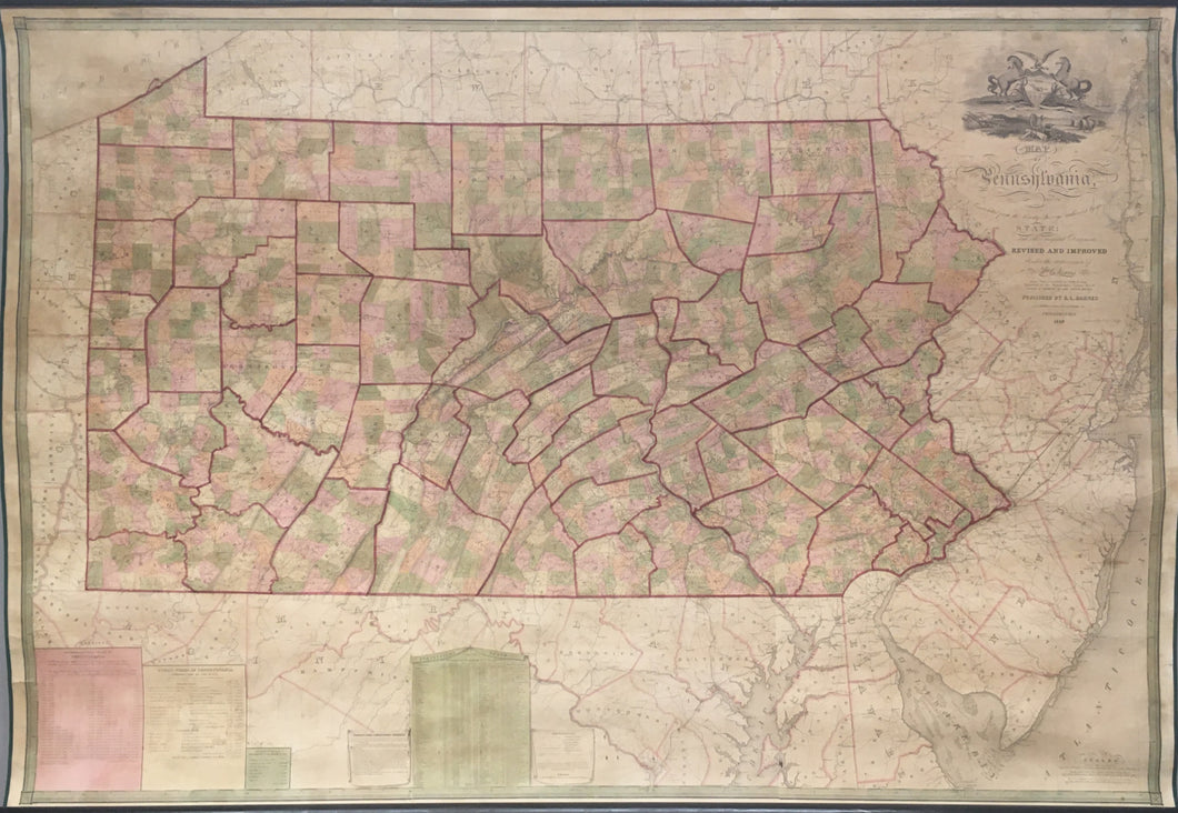
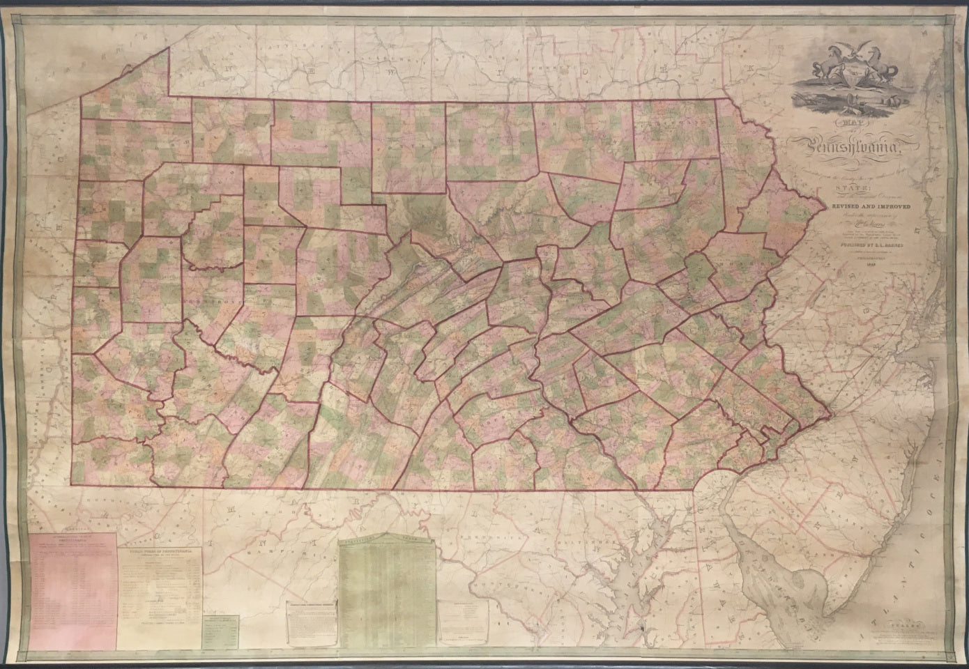
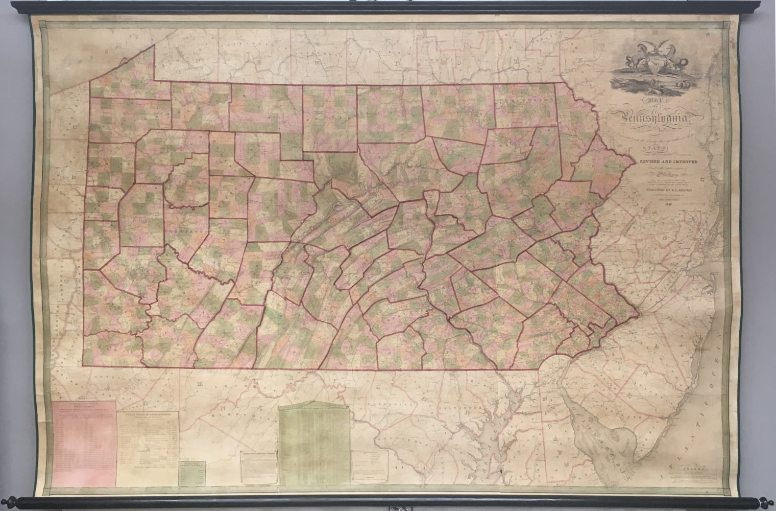
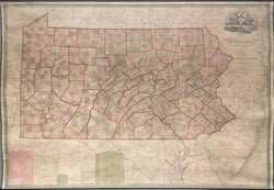
William E. Morris after John Melish. "Map of Pennsylvania, Constructed from the County Surveys authorized by the State; and other original Documents. Revised And Improved Under the supervision of Wm. E. Morris, Civil Engineer."
Philadelphia: R.L. Barnes, [1848]-1849. Copyright, R.L. Barnes 1848. 50 x 74. Engraving by Edward Yeager. Original hand color. Conserved and mounted on new linen backing. Very good condition.
In 1816, the Pennsylvania State legislature passed a law to produce an official state map, and this project was given to the supervision of Philadelphia mapmaker John Melish. Melish called for each county to produce a standardized map, which he would then use to compile a full state map. He worked for six years on this map, which was finally produced in 1822, with revised editions issued in 1824, 1826, and 1832. As each of these maps was produced, one could see the internal growth and development of the state, with new roads and canals, settlements and other features making their appearance with each new issue.
By the 1830s, however, it became clear that the tremendous growth of the state demanded an updated and revised version of this official state map. Civil Engineer William E. Morris was authorized to gather updated information from each county, and he proceeded to 'revise and improve' Melish's map, with the new engravings done by Philadelphia craftsman Edward Yeager. The map was copyrighted and first issued in 1848 and this example was issued a year later with some updating. The size of this map and its myriad public uses determined that the map would be issued in the format of a wall map. Its sheets were joined, mounted on canvas, and varnished so that it could be hung in public places throughout the state. Added along the bottom of the map are several tables of information. These include: "Anthracite Coal Trade of Pennsylvania," "Public Works of Pennsylvania," "Approximate Estimate of Bituminous Coal Mined in 1847," and "Statistical Table Shewing [sic] The Prominent Features of each County." It map is a superb picture of Pennsylvania at mid-century and it is the last of the great engraved maps of the state.
 %20%0A%20%0Ahttps://philaprintshop.com/products/morris-after-melish-map-of-pennsylvania-constructed-from-the-county-surveys-authorized-by-the-state-and-other-original-documents-revised-and-improved-under-the-supervision-of-wm-e-morris-civil-engineer %20%0A%20%0AMorris%20after%20Melish%20%22Map%20of%20Pennsylvania,%20Constructed%20from%20the%20County%20Surveys%20authorized%20by%20the%20State;%20and%20other%20original%20Documents...%22 %20%0A%20%0A//philaprintshop.com/cdn/shop/products/melishpac_1024x1024.jpg?v=1649183635 %20%0A%20%0AAntique Prints, Maps, Drawings, Paintings and Rare Books! %20%0A%20%0AThe Philadelphia Print Shop %20%0A106 E. Lancaster Avenue, Lower Level %20%0AWayne, PA 19087 %20%0A%20%0APhilaPrintShop.com %20%0A@PhiladelphiaPrintShop %20%0A 610 (808) 6165)