

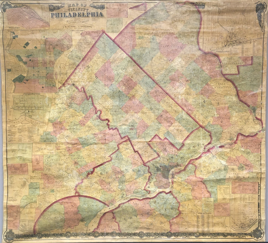

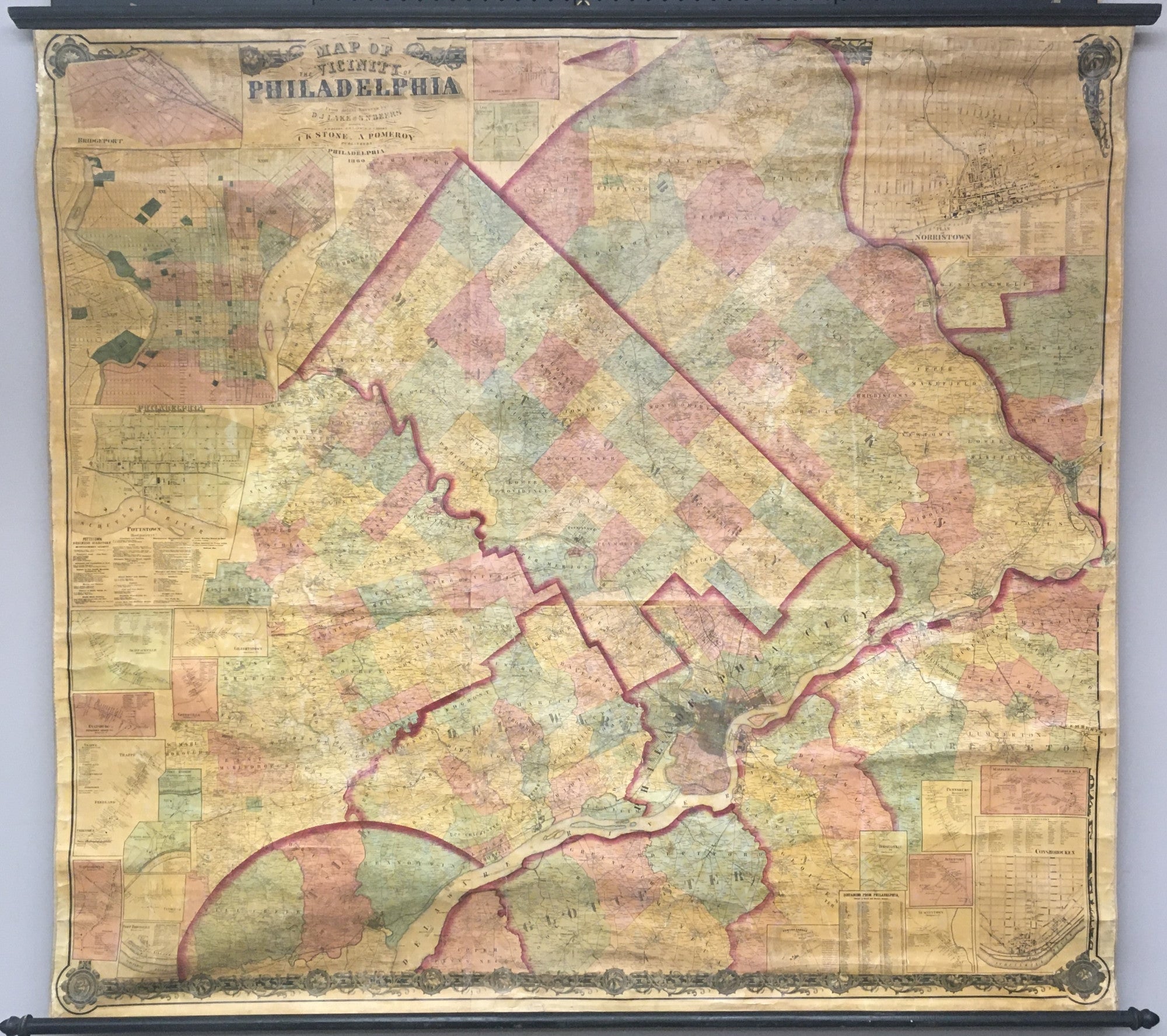
D. J. Lake & S. N. Beers surveyors. “Map of the Vicinity of Philadelphia.”
Philadelphia: C.K. Stone & A. Pomeroy, 1860. 65 x 63. Separately issued wall map, mounted on original linen backing, and varnished. Lithograph. Original hand color. Original ribbon edge binding. Varnish has oxidized and the map surface has acquired a light brown patina, as to be expected; map is generally clean. Numerous small cracks in map surface as to be expected for wall maps of this period. Any small loose areas of printed map surface re-adhered to canvas backing. Acid free linen tape applied on verso, mostly at the top, to reinforce and flatten selected areas of the map. Small area at top of map skillfully filled and in-painted. With original rollers. Otherwise, map is in very good condition for such a large wall map.
Area shown: Philadelphia and western suburbs; with parts of southern New Jersey. Including: Philadelphia County, Delaware County, Montgomery and Bucks Counties, eastern Chester County, northern part of state of Delaware, part of Burlington County, part of Gloucester County and part of Trenton.
Inset maps of Montgomery County: Philadelphia, Norristown, Bridgeport, Conshohocken, Barren Hill, Jenkintown, Plymouth, Hatborough, Springmill, Skippackville, Pottstown, Pennsburg, Sumneytown, Horshamville, Marblehall and Barren Hill, Gilbertstown, Greenville, Evansburg, Trappe. Spring Mill, Port Providence, Port Kennedy, and Limerick Square. Line Lexington in Bucks County.
This large, separately issued map of Philadelphia, the western suburbs and parts of southern New Jersey is in surprisingly good condition. As a piece of Philadelphia history, the map stands as an early example of the fully incorporated city, with boundaries extending to its final state in 1857. Detail throughout the map is quite amazing, showing the names of specific landowners throughout the large land area as well as roads and landmarks. Also, there are numerous inset maps of towns in Montgomery County which are depicted in great detail. A fascinating and impressive separately-issued map.
The southern mate to this wall map

 %20%0A%20%0Ahttps://philaprintshop.com/products/lake-d-j-beers-s-n-beers-surveyors-map-of-the-vicinity-of-philadelphia %20%0A%20%0ALake,%20D.%20J.%20%26%20Beers,%20S.%20N.%20surveyors%20%E2%80%9CMap%20of%20the%20Vicinity%20of%20Philadelphia%E2%80%9D %20%0A%20%0A//philaprintshop.com/cdn/shop/files/stonepomeroyphilawallc_1024x1024.jpg?v=1704471977 %20%0A%20%0AAntique Prints, Maps, Drawings, Paintings and Rare Books! %20%0A%20%0AThe Philadelphia Print Shop %20%0A106 E. Lancaster Avenue, Lower Level %20%0AWayne, PA 19087 %20%0A%20%0APhilaPrintShop.com %20%0A@PhiladelphiaPrintShop %20%0A 610 (808) 6165)