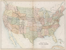
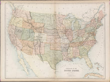
J. Bartholomew Jr. “General Map of the United States.” From Black’s General Atlas of the World.
Edinburgh: A. & C. Black, 1865. 16 1/4 x 21 1/2. Lithograph printed in colors. Full original hand color. Very good condition.
An interesting map of the United States by one of the leading British mapmaking firms of the nineteenth century. Adam and Charles Black issued atlases from the 1840s through the 1880s, working to keep their maps as up-to-date as possible but unfortunately this map shows old and new information in the American West.
The Dakota Territory extends from Minnesota through present-day Montana to the border of Washington Territory. Idaho lacks its upper panhandle and includes today’s Wyoming. The Idaho panhandle was created when Montana Territory was formed in 1864. This map shows the eastern border of Nevada Territory before a narrow horizontal portion of western Utah was ceded in 1862. The Arizona Territory is shown which was created from the New Mexico Territory in 1863. Nevada lacks its southern tip which it will gain from Arizona in 1867.


