

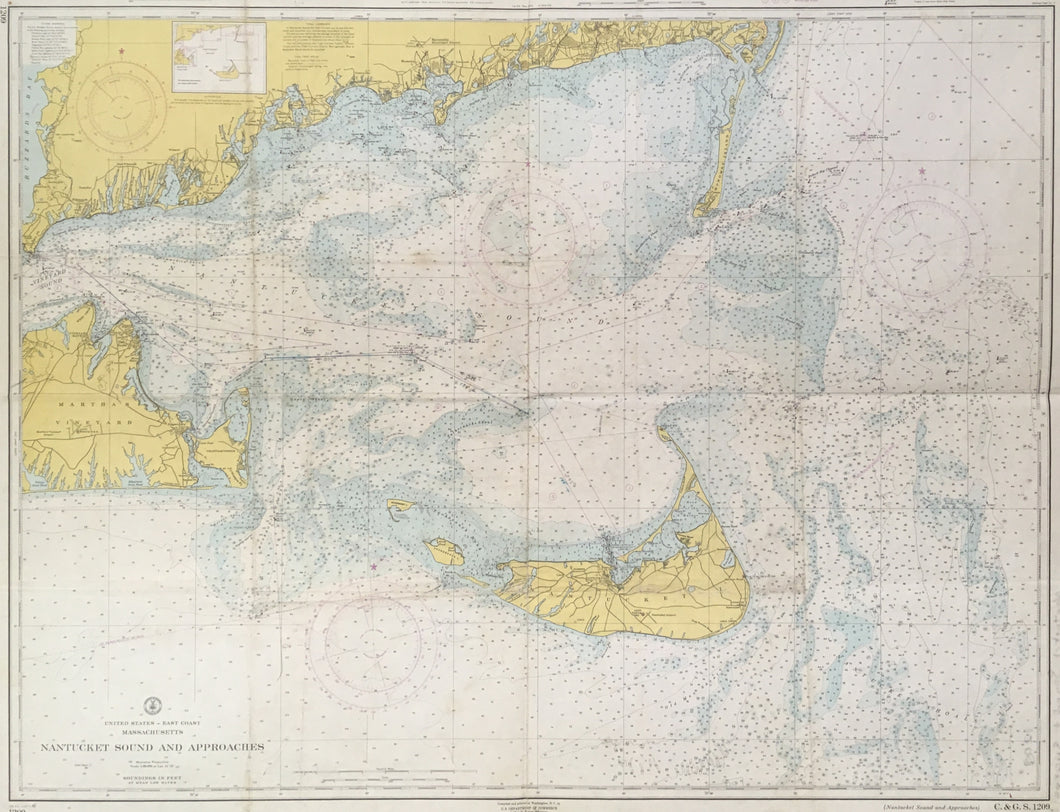
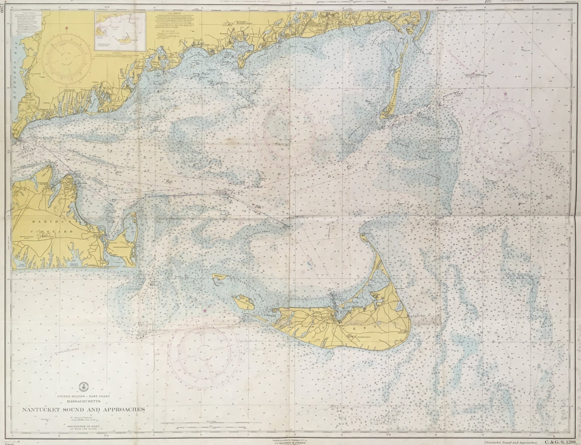
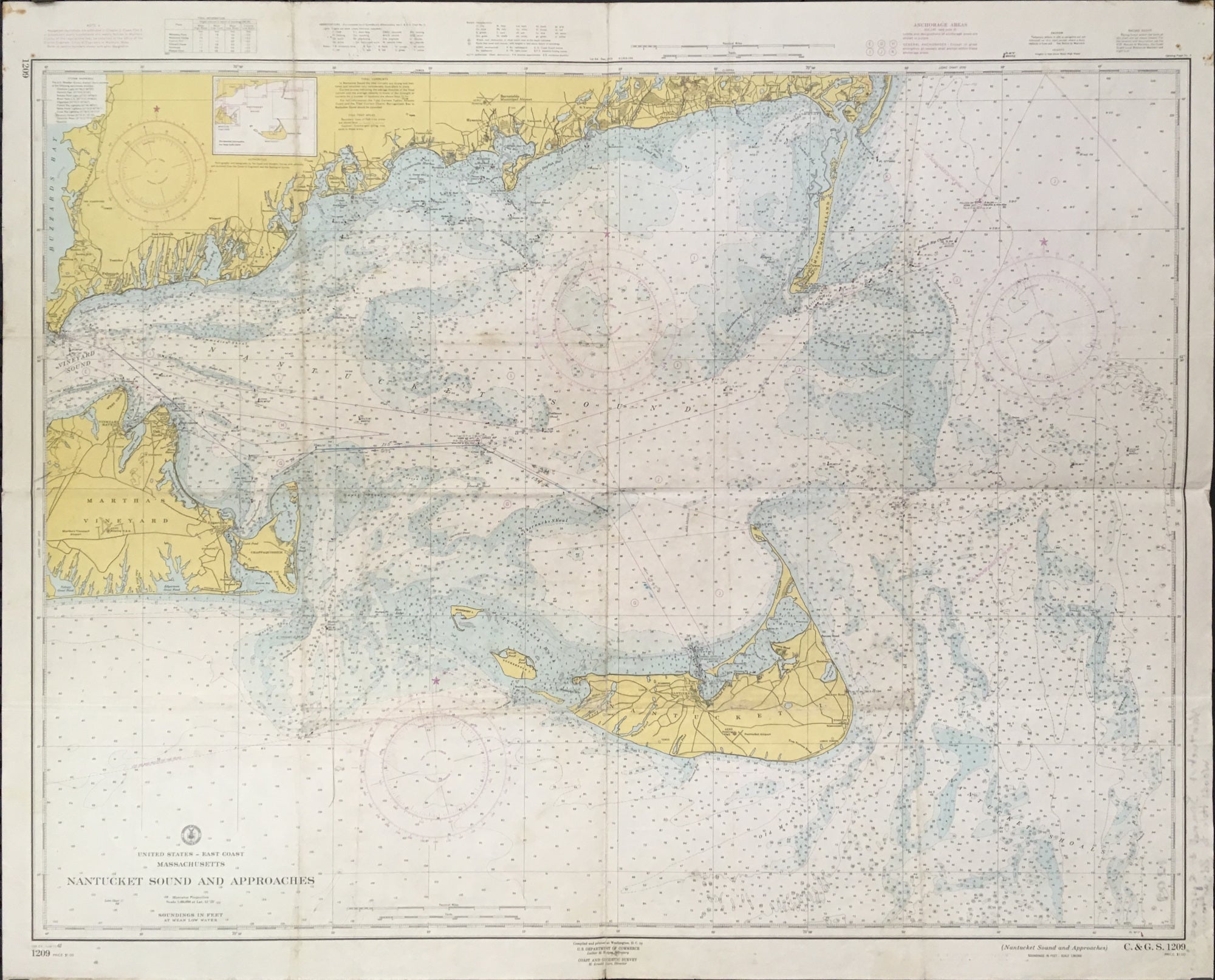
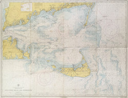
“Nantucket Sound and Approaches.”
Washington D.C.: U.S. Coast and Geodetic Survey, [1919]-1962. Tenth edition. Separately issued United States Coast Survey Chart. 34 ¾ x 43 ¼ (sheet). Lithograph. With folds as originally issued. Three small repaired tears along folds. Some wear, soiling, and browning along folds with some manuscript notation in map indicating map was used. Otherwise, good condition.
The United States Coast Survey was created in 1807, responsible for conducting surveys of the country’s coast and producing detailed charts for the use of American mariners. The creation of this agency was in response to the obvious need for accurate navigational information to ensure the safety of ships and allow for the military and economic needs of the nation. The development of the Coast Survey reflects the growth of Nineteenth Century American physical science. The evolution of many facets of the disciplines of Geodesy, Geophysics, Hydrography, Topography, and Oceanography can be traced in the reports of the Coast Survey. The Survey was continental in scope, tying together east and west coasts by an invisible transcontinental network of triangles, laying the ground work for the progress of American commerce by means of precise nautical charting surveys into the ports of our Atlantic, Gulf, and Pacific shores.
The charts produced by the U.S. Coast Survey are remarkable documents. These charts were sold as separate sheets for anyone sailing along the American coast. Based on the latest scientific surveys they present an amazing amount of accurate detail of the American coastal waters, presented in a clear and quite attractive format. Each sheet contained descriptive notes, sailing directions, and information on tides, currents, soundings, lighthouses, and magnetic variations. Survey information was given for some distance inland, showing towns, creeks, roads, fields, and much other detail.
 %20%0A%20%0Ahttps://philaprintshop.com/products/united-states-coast-survey-nantucket-sound-and-approaches %20%0A%20%0AUnited%20States%20Coast%20Survey%20%E2%80%9CNantucket%20Sound%20and%20Approaches%E2%80%9D %20%0A%20%0A//philaprintshop.com/cdn/shop/products/nantucketsoundc_1024x1024.jpg?v=1681403658 %20%0A%20%0AAntique Prints, Maps, Drawings, Paintings and Rare Books! %20%0A%20%0AThe Philadelphia Print Shop %20%0A106 E. Lancaster Avenue, Lower Level %20%0AWayne, PA 19087 %20%0A%20%0APhilaPrintShop.com %20%0A@PhiladelphiaPrintShop %20%0A 610 (808) 6165)