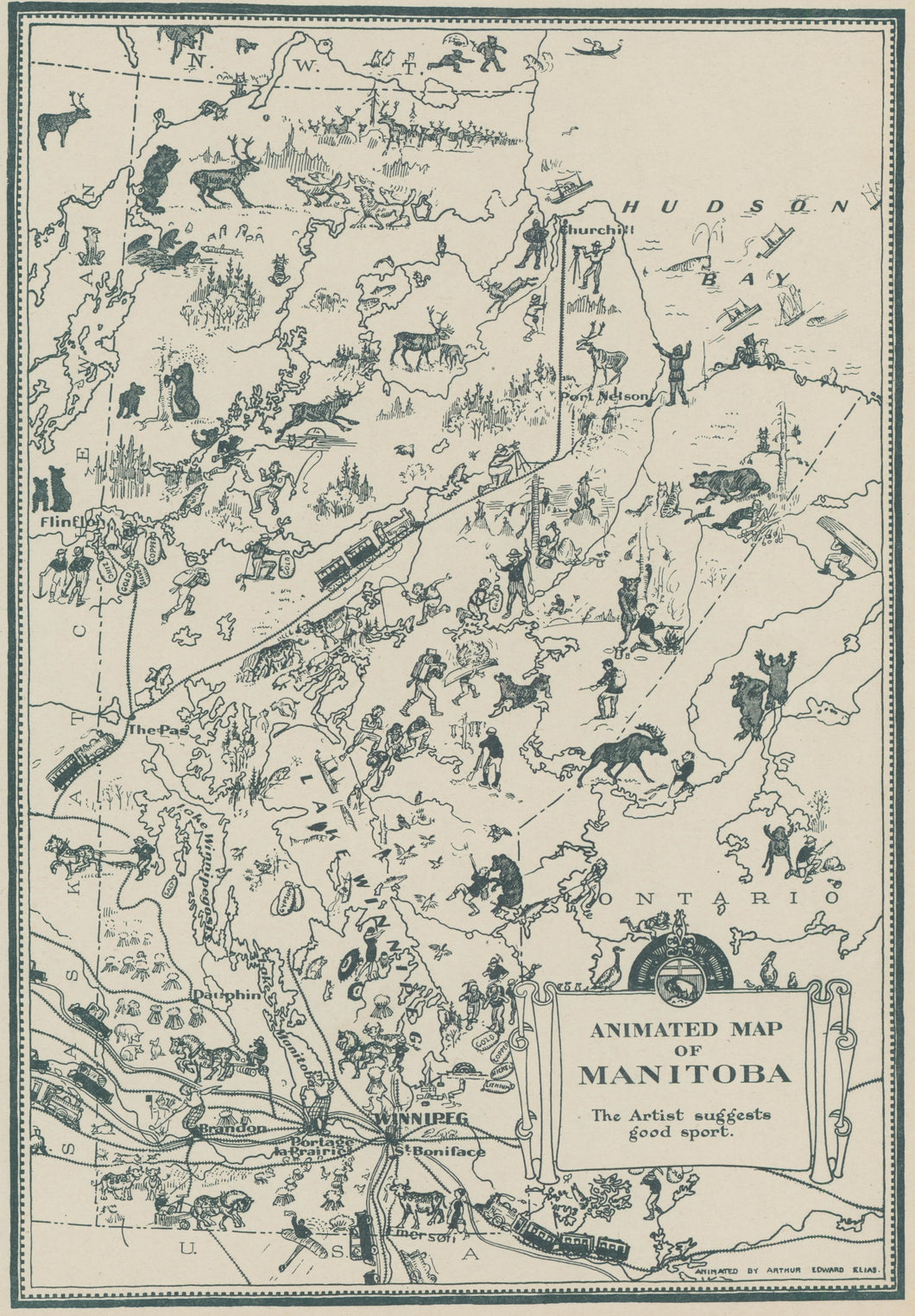
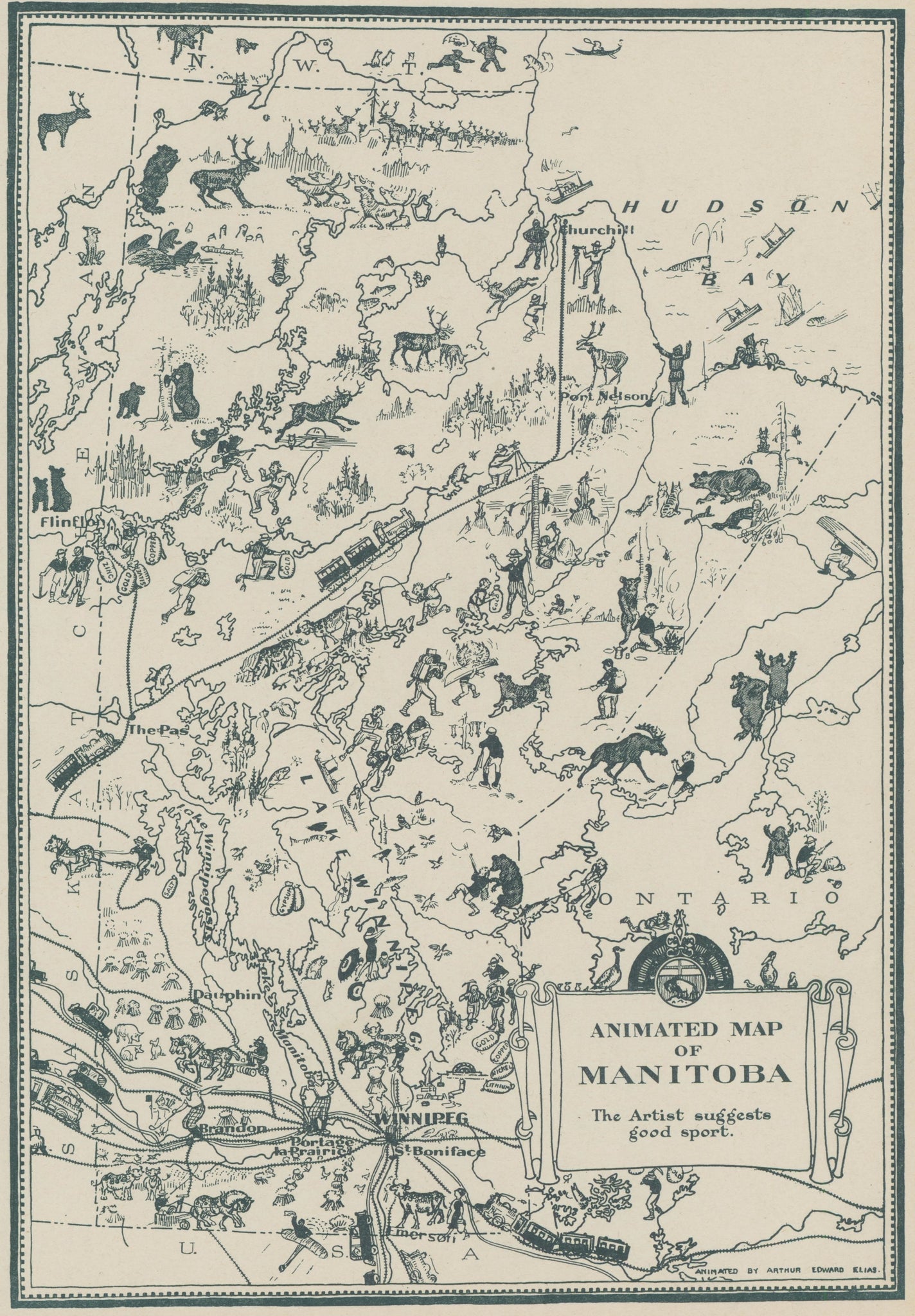
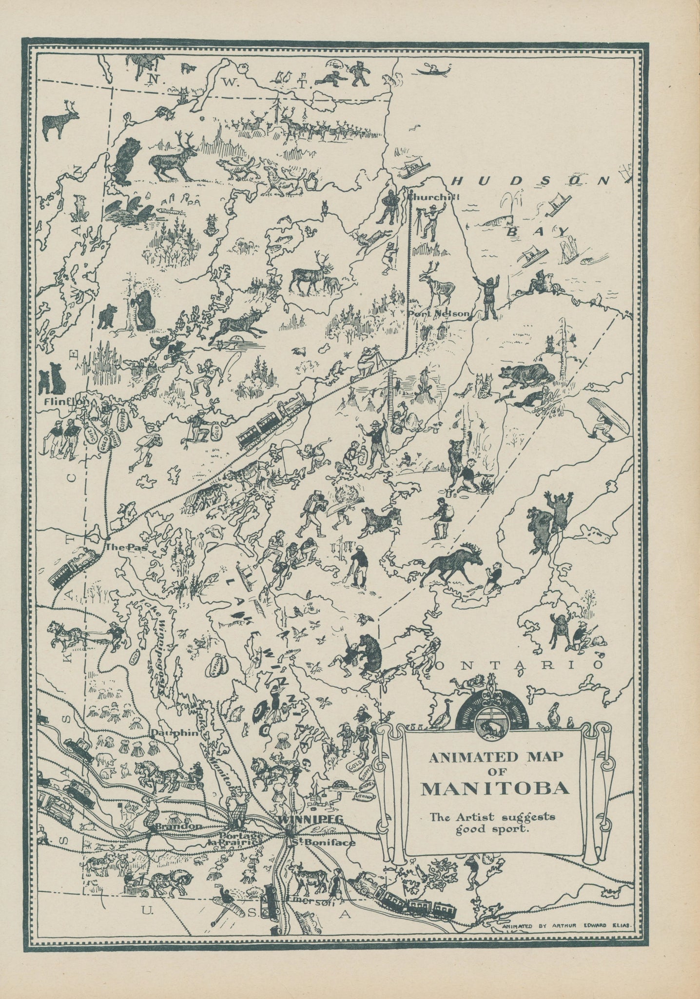
Arthur Edward Elias. “Animated Map of Manitoba. The Artist suggests good sport.”
From Commercial Atlas of the World. Chicago: Geographical Publishing Company, 1931. Lithograph. 13 7/8 x 9 5/8 (neat lines). A few repaired short tears in margins. Very good condition.


 %20%0A%20%0Ahttps://philaprintshop.com/products/elia-arthur-edward-animated-map-of-manitoba %20%0A%20%0AElias,%20Arthur%20Edward%20%20%E2%80%9CAnimated%20Map%20of%20Manitoba.%22 %20%0A%20%0A//philaprintshop.com/cdn/shop/files/eliasmanitobathmb_1024x1024.jpg?v=1698942438 %20%0A%20%0AAntique Prints, Maps, Drawings, Paintings and Rare Books! %20%0A%20%0AThe Philadelphia Print Shop %20%0A106 E. Lancaster Avenue, Lower Level %20%0AWayne, PA 19087 %20%0A%20%0APhilaPrintShop.com %20%0A@PhiladelphiaPrintShop %20%0A 610 (808) 6165)