

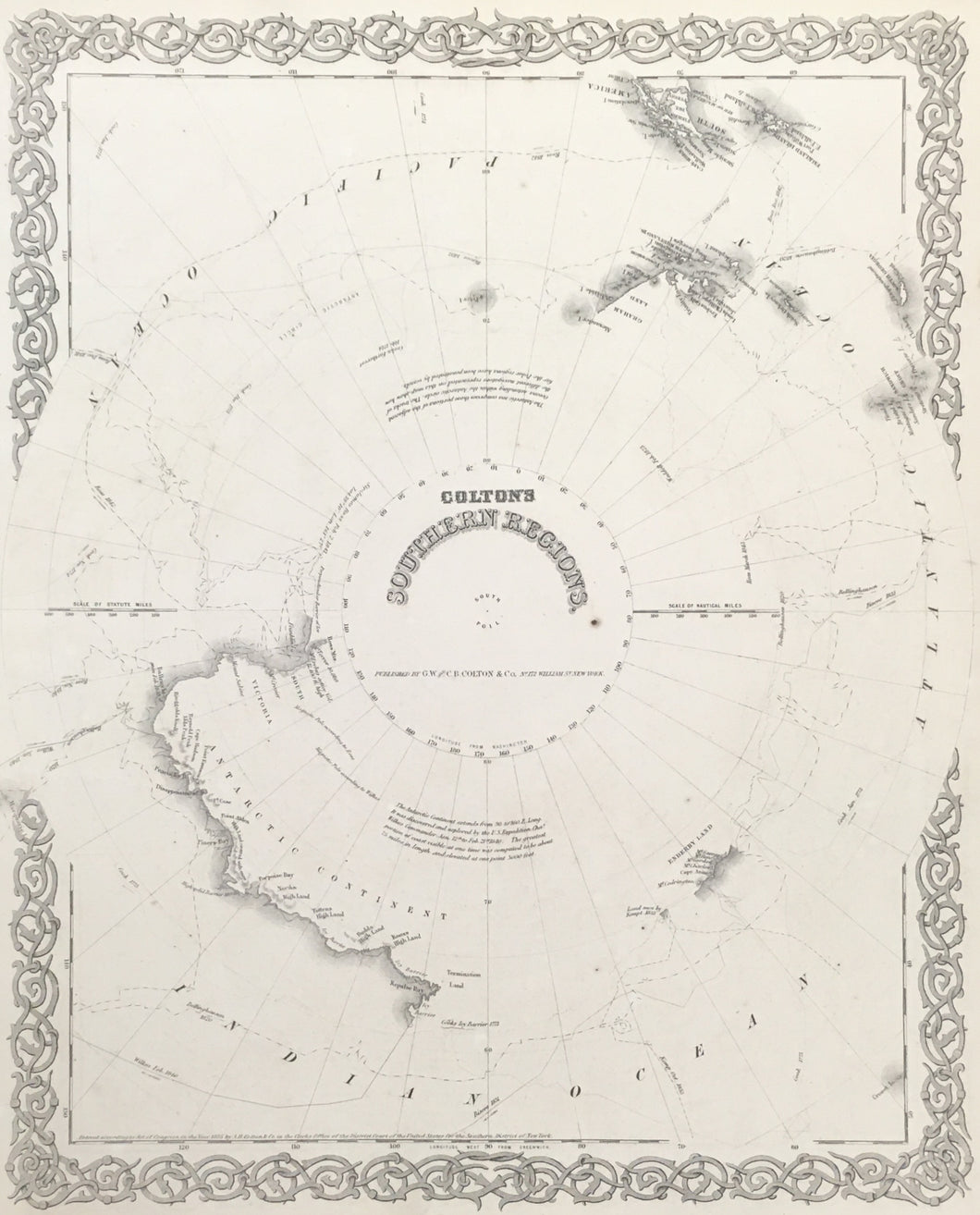
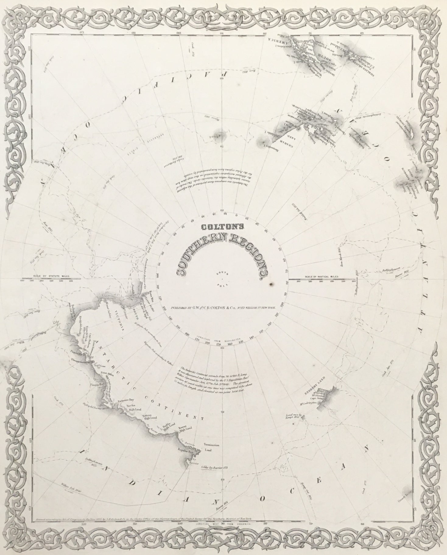
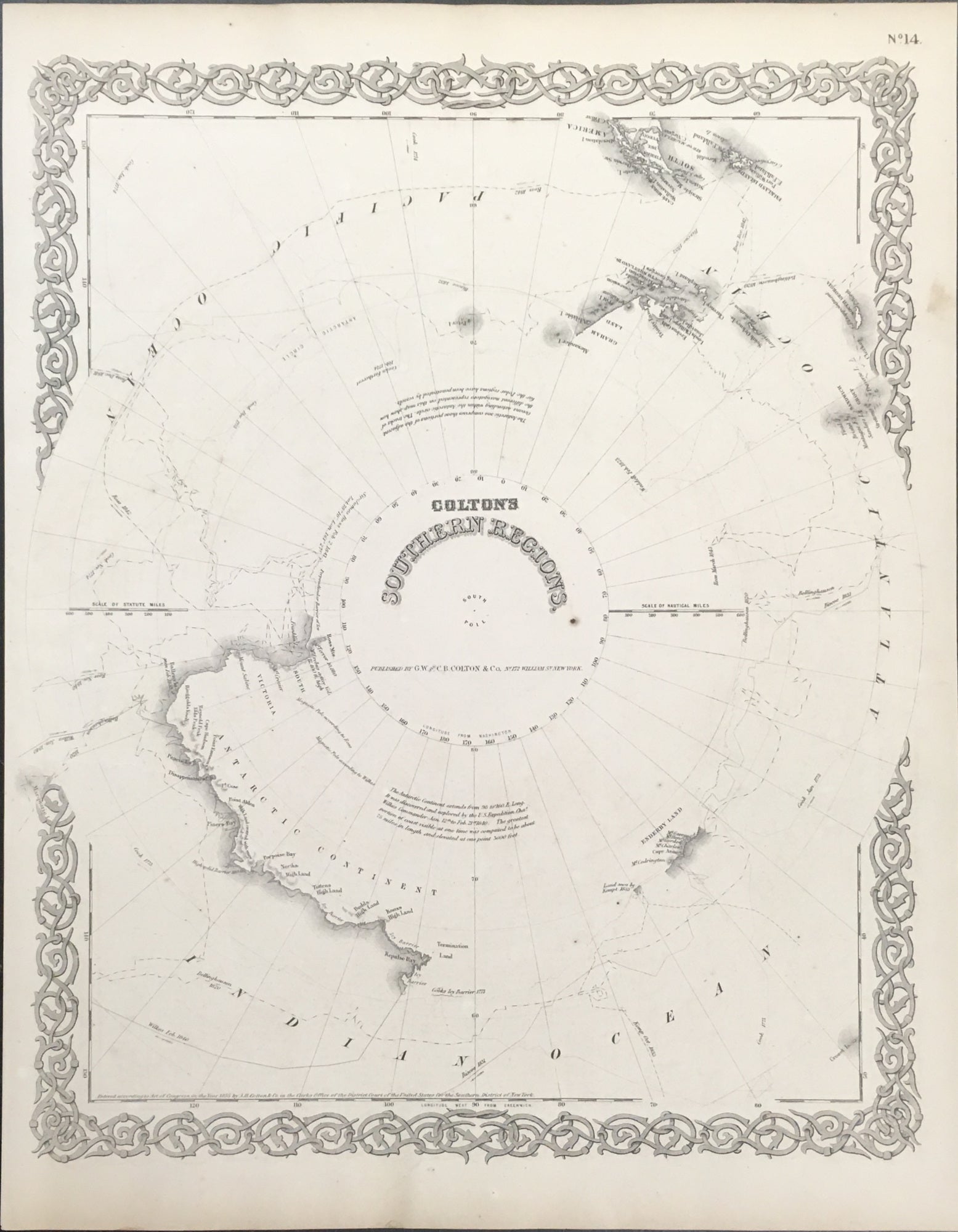
"Colton's Southern Regions."
New York: J.H. Colton, 1855. 15 3/4 x 13 1/4. Lithograph. With decorative border. Very good condition.
An attractive and historically interesting map of the incompletely-charted continent of Antarctica by one of the leading American mapmakers of the mid-nineteenth century. The map shows coastline segments along the Indian Ocean and at the juncture of the Atlantic and Pacific, opposite Cape Horn and the Falkland Islands. Routes traveled by explorers are also shown: Cook 1773-4, Bellinghausen 1820, Weddell 1823, Biscoe 1831-2, Kemp 1833, Wilkes 1840 and Ross 1840-2.
 %20%0A%20%0Ahttps://philaprintshop.com/products/colton-j-h-coltons-southern-regions %20%0A%20%0AColton,%20J.H.%20%22Colton's%20Southern%20Regions%22 %20%0A%20%0A//philaprintshop.com/cdn/shop/products/coltonspolec_1024x1024.jpg?v=1681580992 %20%0A%20%0AAntique Prints, Maps, Drawings, Paintings and Rare Books! %20%0A%20%0AThe Philadelphia Print Shop %20%0A106 E. Lancaster Avenue, Lower Level %20%0AWayne, PA 19087 %20%0A%20%0APhilaPrintShop.com %20%0A@PhiladelphiaPrintShop %20%0A 610 (808) 6165)