Adding product to your cart
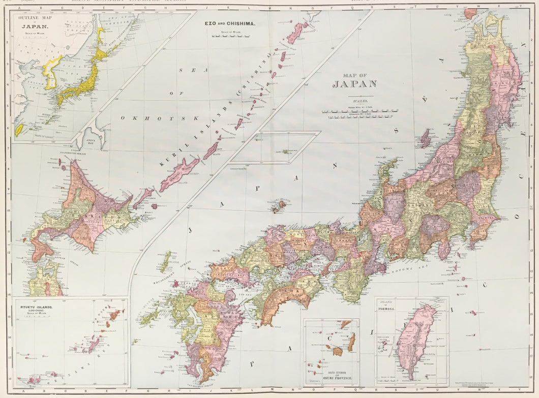
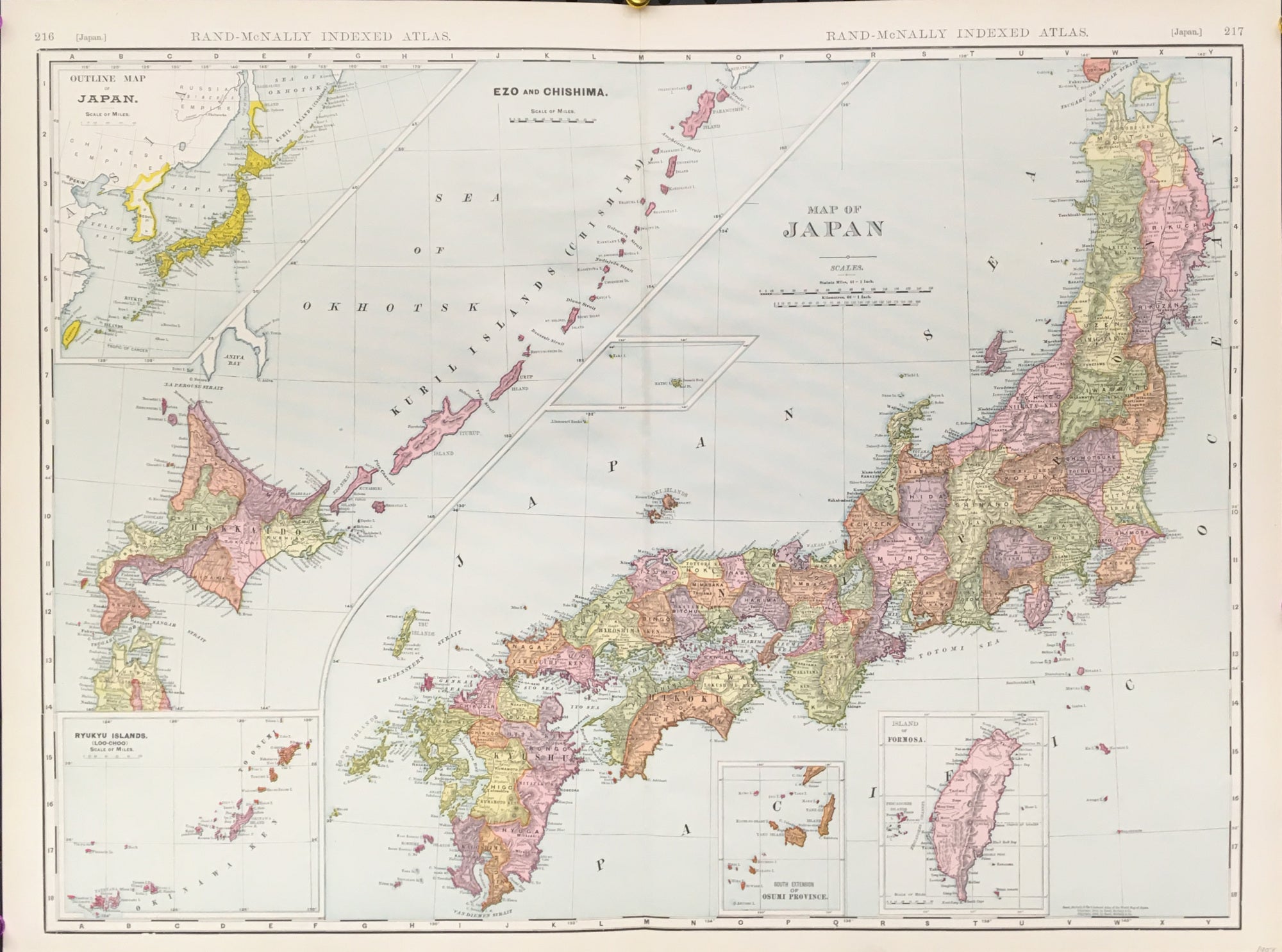
Rand McNally. "Japan." with insets: "Outline Map of Japan," "Ezo and Chishima," "Ryukyu Islands," "South Extension of Osumi Province," and "Island of Formosa." From Indexed Atlas Of The World.
Chicago: Rand, McNally & Co., 1904. 19 x 26. Cerograph. Full original color. Very good condition.
An early 20th century map from the early days of the Rand, McNally & Co. firm out of Chicago, a company that would shift the center of cartographic publishing from the east coast to the mid-west. Typical of the work from the firm, this map has very good detail precisely and neatly exhibited. Inserts of the Ryukyu Islands, Osumi Province, and the Island of Formosa (which had recently been ceded to by China in 1895 by the Treaty of Shimonoseki ) appear along the lower border. An outline map of Japan appears in the upper, left corner and Ezo and Chishima are detailed in an diagonal across the left of the page. Aesthetically and cartographically, a foreshadow of the maps of the twentieth century.
Use left/right arrows to navigate the slideshow or swipe left/right if using a mobile device


 %20%0A%20%0Ahttps://philaprintshop.com/products/rand-mcnally-japan-with-insets-outline-map-of-japan-ezo-and-chishima-ryukyu-islands-south-extension-of-osumi-province-island-of-formosa %20%0A%20%0ARand-McNally%20%22Japan.%22%20with%20insets:%20%22Outline%20Map%20of%20Japan,%22%20%22Ezo%20and%20Chishima,%22%20%22Ryukyu%20Islands,%22%20%22South%20Extension%20of%20Osumi%20Province,%22%20%26%20%22Island%20of%20Formosa%22 %20%0A%20%0A//philaprintshop.com/cdn/shop/products/rand-japanc_1024x1024.jpg?v=1677868258 %20%0A%20%0AAntique Prints, Maps, Drawings, Paintings and Rare Books! %20%0A%20%0AThe Philadelphia Print Shop %20%0A106 E. Lancaster Avenue, Lower Level %20%0AWayne, PA 19087 %20%0A%20%0APhilaPrintShop.com %20%0A@PhiladelphiaPrintShop %20%0A 610 (808) 6165)