

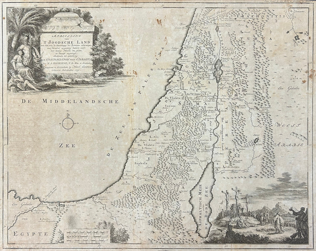


Willem Albert Bachiene. "Afbeelding van 't Joodsche Land."
Gorinchem, Uitgegeven: Nicolaas Goetzee, 1750. 15 x 18 1/2. Engraving J. van Jagen. Some scattered staining; else good condition.
A map of Palestine during the rule of Rome. This map was drawn by Willem Albert Bachiene, a Dutch preacher, astronomer, and geographer who produced a number of maps, such as this one, of the Holy Land for use in mid-eighteenth century bibles. A decorative vignette in the lower right shows the crucifixion, and an elaborate baroque title cartouche is in the upper left, with a depiction of the Crucifixion in the lower right.
 %20%0A%20%0Ahttps://philaprintshop.com/products/bachiene-willem-albert-afbeelding-van-t-joodsche-land %20%0A%20%0ABachiene,%20Willem%20Albert%20%22Afbeelding%20van%20't%20Joodsche%20Land%22 %20%0A%20%0A//philaprintshop.com/cdn/shop/files/bachienejoodschec_1024x1024.jpg?v=1701544105 %20%0A%20%0AAntique Prints, Maps, Drawings, Paintings and Rare Books! %20%0A%20%0AThe Philadelphia Print Shop %20%0A106 E. Lancaster Avenue, Lower Level %20%0AWayne, PA 19087 %20%0A%20%0APhilaPrintShop.com %20%0A@PhiladelphiaPrintShop %20%0A 610 (808) 6165)